The key points are temporarily unavailable. You can still read the full Story below.
Main Points
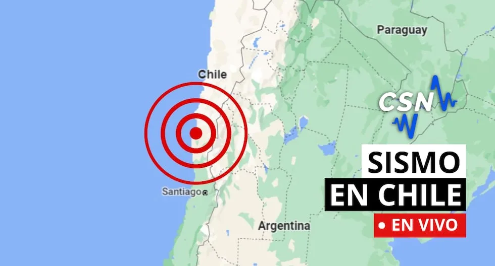
On 5 November 2026 the Chilean National Seismological Center (CSN) recorded a series of moderate earthquakes across the country. The events, all with magnitudes between 2.5 and 3.3 on the local magnitude scale (MLv), occurred at depths ranging from 28 km to 218 km and were distributed from the north‑western Atacama region to the south‑eastern part of the country. Earthquake details | Time (local) | Location | Latitude | Longitude | Depth (km) | Magnitude (MLv) | |————–|———-|———-|———–|————|—————–| | 20:44:43 | 66 km NE of Calama | –21.96 | –68.61 | 115 | 2.5 | | 18:54:19 | 40 km SE of Mina La Escondida | –24.58 | –68.86 | 100 | 3.3 | | 18:22:48 | 67 km SW of Ollagüe | –21.78 | –68.50 | 132 | 2.8 | | 18:14:52 | 81 km NE of San Pedro de Atacama | –22.25 | –67.89 | 205 | 3.3 | | 17:18:56 | 41 km NE of Calama | –22.32 | –68.57 | 196 | 2.6 | | 16:17:18 | 19 km NE of Calama | –22.33 | –68.82 | 110 | 2.8 | | 15:54:23 | 22 km SW of Mina Collahuasi | –20.94 | –68.82 | 28 | 2.5 | | 15:50:12 | 46 km SW of Ollagüe | –21.60 | –68.43 | 125 | 2.7 | | 15:35:19 | 39 km SW of Mina Collahuasi | –20.98 | –68.99 | 96 | 2.8 | | 15:06:40 | 38 km N of Los Vilos | –31.73 | –71.86 | 27 | 2.7 | | 14:50:06 | 75 km W of San Antonio de los Cobres | –24.11 | –67.04 | 218 | 2.6 | | 11:36:48 | 35 km N of Camiña | –19.01 | –69.54 | 72 | 2.7 | | 09:32:37 | 36 km N O of Mina La Escondida | –24.02 | –69.28 | 82 | 3.3 | | 09:02:00 | 62 km W of Ollagüe | –21.38 | –68.83 | 119 | 2.6 | | 08:25:52 | 27 km NE of Farellones | –33.15 | –70.15 | 96 | 2.5 | | 07:24:44 | 28 km E of Constitución | –35.28 | –72.10 | 62 | 2.8 | The CSN continues to monitor seismic activity and provides real‑time updates on its website and through official channels. Context and safety information Chile lies on the western margin of the South American Plate, where the Nazca and Antarctic plates converge. This tectonic setting places the country within the Pacific Ring of Fire, a region known for frequent earthquakes and volcanic activity. The most powerful earthquake recorded in Chile occurred on 22 May 1960 in Valdivia, with a magnitude of 9.5. The CSN and emergency authorities recommend that residents prepare an emergency kit that includes hygiene items, a basic first‑aid kit (bandages, gauze, antiseptic, etc.), warm clothing, non‑perishable food, water, a battery‑powered radio or other communication devices, and any special items needed for infants, the elderly, or people with medical conditions. In the event of an earthquake, authorities advise avoiding elevators, as they can become trapped or collapse. If a tsunami alert is issued, residents should evacuate to higher ground or move to the nearest safe location. While the magnitude scale measures the energy released by an earthquake, the intensity scale describes the observed effects on people, structures, and the environment. Chile’s seismic monitoring network continues to refine these measurements to improve public safety and preparedness. Article source: El Comercio | Image credit: El Comercio
On 5 November 2026 the Chilean National Seismological Center (CSN) recorded a series of moderate earthquakes across the country. The events, all with magnitudes between 2.5 and 3.3 on the local magnitude scale (MLv), occurred at depths ranging from 28 km to 218 km and were distributed from the north‑western Atacama region to the south‑eastern part of the country. Earthquake details | Time (local) | Location | Latitude | Longitude | Depth (km) | Magnitude (MLv) | |————–|———-|———-|———–|————|—————–| | 20:44:43 | 66 km NE of Calama | –21.96 | –68.61 | 115 | 2.5 | | 18:54:19 | 40 km SE of Mina La Escondida | –24.58 | –68.86 | 100 | 3.3 | | 18:22:48 | 67 km SW of Ollagüe | –21.78 | –68.50 | 132 | 2.8 | | 18:14:52 | 81 km NE of San Pedro de Atacama | –22.25 | –67.89 | 205 | 3.3 | | 17:18:56 | 41 km NE of Calama | –22.32 | –68.57 | 196 | 2.6 | | 16:17:18 | 19 km NE of Calama | –22.33 | –68.82 | 110 | 2.8 | | 15:54:23 | 22 km SW of Mina Collahuasi | –20.94 | –68.82 | 28 | 2.5 | | 15:50:12 | 46 km SW of Ollagüe | –21.60 | –68.43 | 125 | 2.7 | | 15:35:19 | 39 km SW of Mina Collahuasi | –20.98 | –68.99 | 96 | 2.8 | | 15:06:40 | 38 km N of Los Vilos | –31.73 | –71.86 | 27 | 2.7 | | 14:50:06 | 75 km W of San Antonio de los Cobres | –24.11 | –67.04 | 218 | 2.6 | | 11:36:48 | 35 km N of Camiña | –19.01 | –69.54 | 72 | 2.7 | | 09:32:37 | 36 km N O of Mina La Escondida | –24.02 | –69.28 | 82 | 3.3 | | 09:02:00 | 62 km W of Ollagüe | –21.38 | –68.83 | 119 | 2.6 | | 08:25:52 | 27 km NE of Farellones | –33.15 | –70.15 | 96 | 2.5 | | 07:24:44 | 28 km E of Constitución | –35.28 | –72.10 | 62 | 2.8 | The CSN continues to monitor seismic activity and provides real‑time updates on its website and through official channels. Context and safety information Chile lies on the western margin of the South American Plate, where the Nazca and Antarctic plates converge. This tectonic setting places the country within the Pacific Ring of Fire, a region known for frequent earthquakes and volcanic activity. The most powerful earthquake recorded in Chile occurred on 22 May 1960 in Valdivia, with a magnitude of 9.5. The CSN and emergency authorities recommend that residents prepare an emergency kit that includes hygiene items, a basic first‑aid kit (bandages, gauze, antiseptic, etc.), warm clothing, non‑perishable food, water, a battery‑powered radio or other communication devices, and any special items needed for infants, the elderly, or people with medical conditions. In the event of an earthquake, authorities advise avoiding elevators, as they can become trapped or collapse. If a tsunami alert is issued, residents should evacuate to higher ground or move to the nearest safe location. While the magnitude scale measures the energy released by an earthquake, the intensity scale describes the observed effects on people, structures, and the environment. Chile’s seismic monitoring network continues to refine these measurements to improve public safety and preparedness.
News Desk is the editorial publishing account for Tringlobe Media News, covering breaking news, public affairs, entertainment, community developments and regional stories across Trinidad and Tobago, the Caribbean and internationally.