The key points are temporarily unavailable. You can still read the full Story below.
Main Points
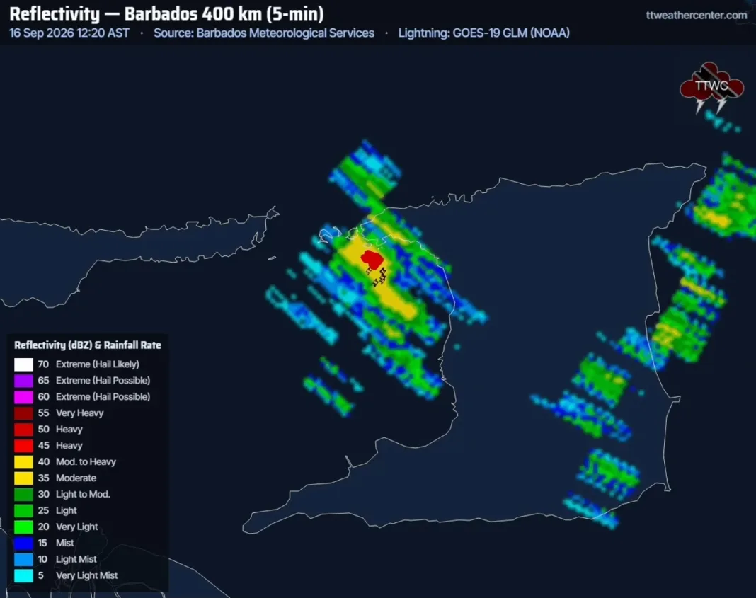
At 2:35 p.m., weather reports show isolated thunderstorms and heavy showers continuing across western Trinidad. The heaviest rainfall has fallen in the northwest, leaving parts of the region drenched and vulnerable to flash flooding.
In the past hour, Port of Spain and Diego Martin recorded between 20 and 50 millimetres of rain, according to the Trinidad and Tobago Weather Centre. Residents have reported sporadic street flooding in several streets, prompting local authorities to issue precautionary notices.
Meanwhile, the southern and eastern halves of the island remain largely hot and sunny, offering a stark contrast to the wet conditions in the west. Travelers in those areas can expect clear skies and mild temperatures.
Meteorologists warn that a low‑level convergence zone is expected to move onshore later this afternoon, raising the chances of additional showers and isolated thunderstorms around 5 p.m. The forecast calls for a gradual increase in rainfall intensity across the western belt.
Residents are advised to stay updated on local weather alerts, avoid low‑lying roads during peak rainfall, and keep emergency supplies on hand. For the latest updates, visit the Trinidad and Tobago Weather Centre website.