The key points are temporarily unavailable. You can still read the full Story below.
Main Points
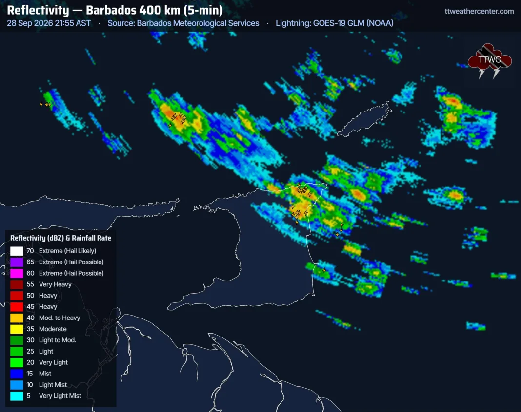
At 10:00 PM a cluster of thunderstorms rolled into northeastern Trinidad, heading westward before curving southwest across the island. Simultaneously, showers pushed onshore the eastern coastline, bringing additional moisture to that region.
Meteorologists warn that the unsettled pattern will linger through the night, with the greatest rainfall expected over eastern Trinidad. The system’s slow movement means rain will be prolonged in that area.
The primary threats are locally heavy rainfall that can produce short‑lived street flooding or flash floods, gusty winds that may knock down unsecured items, and frequent lightning strikes typical of intense thunderstorm activity.
Authorities recommend that residents stay clear of low‑lying roads, secure outdoor furniture, and monitor local alerts. Drivers should exercise caution, as flash‑flooded streets can appear suddenly.
For the latest updates, viewers can consult the Trinidad Weather Centre’s forecast page at the provided link.