The key points are temporarily unavailable. You can still read the full Story below.
Main Points
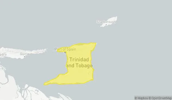
Trinidad and Tobago can expect a mix of clouds and rain today, with the highest chance of heavy showers and thunderstorms in southern Trinidad, according to the latest official forecast from the Meteorological Office. For Trinidad, the day will be partly cloudy to cloudy, with occasional periods of light to moderate rainfall interrupted by settled intervals. There is a 60 to 70 percent chance of heavy showers or thunderstorms, particularly in southern regions, though other areas may also be affected. Conditions are expected to become generally settled by late afternoon. Tonight, partly cloudy skies will bring a few showers, with a low 25 percent chance of isolated heavy activity near midnight. In Tobago, the day will feature partly cloudy periods with scattered showers interrupting otherwise fair conditions. The chance of isolated heavy showers or thunderstorms is low to medium at 30 to 40 percent. Tonight mirrors Trinidad’s forecast, with a 25 percent chance of isolated heavy showers or thunderstorms near midnight. The Met Office warns that heavy showers or thunderstorms could produce gusty winds and lead to street or flash flooding in prone areas. Marine interests, particularly small craft operators and sea bathers, are advised to exercise caution. Seas are moderate, with waves ranging from 2.0 to 2.5 metres in open waters and near 1.0 metre, choppy at times, in sheltered areas. Temperatures today are forecast to reach a maximum of 29°C in Piarco and 30°C in Crown Point. The remainder of the Lesser Antilles can expect mostly fair and breezy conditions with a light haze and isolated showers.
Trinidad and Tobago can expect a mix of clouds and rain today, with the highest chance of heavy showers and thunderstorms in southern Trinidad, according to the latest official forecast from the Meteorological Office.
For Trinidad, the day will be partly cloudy to cloudy, with occasional periods of light to moderate rainfall interrupted by settled intervals. There is a 60 to 70 percent chance of heavy showers or thunderstorms, particularly in southern regions, though other areas may also be affected. Conditions are expected to become generally settled by late afternoon. Tonight, partly cloudy skies will bring a few showers, with a low 25 percent chance of isolated heavy activity near midnight.
In Tobago, the day will feature partly cloudy periods with scattered showers interrupting otherwise fair conditions. The chance of isolated heavy showers or thunderstorms is low to medium at 30 to 40 percent. Tonight mirrors Trinidad’s forecast, with a 25 percent chance of isolated heavy showers or thunderstorms near midnight.
The Met Office warns that heavy showers or thunderstorms could produce gusty winds and lead to street or flash flooding in prone areas. Marine interests, particularly small craft operators and sea bathers, are advised to exercise caution. Seas are moderate, with waves ranging from 2.0 to 2.5 metres in open waters and near 1.0 metre, choppy at times, in sheltered areas.
Temperatures today are forecast to reach a maximum of 29°C in Piarco and 30°C in Crown Point. The remainder of the Lesser Antilles can expect mostly fair and breezy conditions with a light haze and isolated showers.
News Desk is the editorial publishing account for Tringlobe Media News, covering breaking news, public affairs, entertainment, community developments and regional stories across Trinidad and Tobago, the Caribbean and internationally.